


Hadrains Wall Walk ,Bowness On Solway


Now taking bookings at BOOKING.COM
Hope and Anchor situated on the sollway firth,either at the start of The Hadrians Wall Walk , or at the end no matter what , we cater for Walkers , Cyclists, Campervans , tourists and locals.
This Traditional Inn, Serving Real ales , coffee, teas & soft drinks a fine selection of beers & spirits , supplying locally sourced Produce , Lunch Menu and Evening Menu Serving all day peek season , from March to October . Reduced times out of season.


Main Street Port Carlisle Wigton Cumbria, CA7 5BU. Tel 016973 51460
Hopeandanchor@mail.com Trading as Thomson Taverns Ltd companies house Registration no 12839059


The National Trail
The 84-mile Hadrian’s Wall Path stretches from England’s east coast to the west, from Wallsend in Tyne and Wear to Bowness on Solway, in Cumbria. Walkers can begin the trail at either end.
In the east, the trail follows a riverside route in Tyneside and winds through farmland in Tynedale. It descends to the rich pastures of Cumbria and eventually the marsh of the Solway Estuary in the west. Along the trail, walkers will stumble upon some of the UK’s most breathtaking views, encompassing rolling hills, moorland, and vibrant city landscapes. However, the trail is more than just a beautiful, scenic walk. It was inspired by the greatest monument from Roman Britain — Hadrian’s Wall.
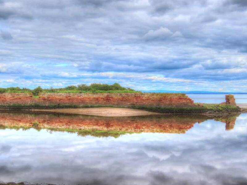
The Hadrian’s Wall Path runs adjacent to parts of the famous Roman wall — a World Heritage Site. The remains of the wall are more evident on certain stretches of the trail. Hadrian’s Wall was the most strongly defended frontier in the Roman Empire. When built by the Romans as a defence fortification from Scotland, Hadrian’s Wall was 73 miles in length, running between the forts of Maia at Bowness on Solway and Segedunum at Wallsend. Roman heritage is still visible on many sections of the trail and walkers can explore numerous Roman forts, preserved masonry, and earthworks. John Scott, management plan coordinator for Hadrian’s Wall Path, recommended exploring the trail between Carlisle and Bowness on Solway.
He said this section was not as well known as central and eastern parts of the trail where the wall was more evident. “People will be blown away by the views at Port Carlisle — it’s a great place to explore. They will get a nice snapshot of the salt marshland. On a clear day, the views of the Scottish mountains in the background are startling" he said.
For further information on National Trails, including Hadrian’s Wall Path, visit www.nationaltrail.co.uk
Historically within Cumberland, its original name was Fisher's Cross, and the portwas built in 1819. Four years later, a canallink was added to take goods to Carlisle Basin. The canal was closed in 1853 and Port Carlisle silted up.
The canal basin at Carlisle and parts of the canal were filled in by the Port Carlisle Railway Company who constructed a railway that started passenger services in 1854, discontinuing them two years later when the railway to Silloth opened. As a cheap alternative, a horse-drawn service was provided in 1856 between Drumburgh and Port Carlisle railway station for a number of years. In 1914 steam power was used and to try to avoid closure a steam railmotor called 'Flower of Yarrow' was built and this service to Port Carlisle railway station lasted until the branch was closed in 1932.
Create Your Own Website With Webador